Show EOL distros:
Package Summary
Maintains a local obstacle map (point cloud, voxels or occupancy grid) from recent sensor readings within a configurable time window.
- Maintainer status: maintained
- Maintainer: Jose-Luis Blanco-Claraco <jlblanco AT ual DOT es>
- Author: Jose-Luis Blanco-Claraco <jlblanco AT ual DOT es>
- License: BSD
- Source: git https://github.com/mrpt-ros-pkg/mrpt_navigation.git (branch: master)
Package Summary
Maintains a local obstacle map (point cloud, voxels or occupancy grid) from recent sensor readings within a configurable time window.
- Maintainer status: maintained
- Maintainer: Jose-Luis Blanco-Claraco <jlblanco AT ual DOT es>
- Author: Jose-Luis Blanco-Claraco <jlblanco AT ual DOT es>
- License: BSD
- Source: git https://github.com/mrpt-ros-pkg/mrpt_navigation.git (branch: ros1)
Package Summary
Maintains a local obstacle map (point cloud, voxels or occupancy grid) from recent sensor readings within a configurable time window.
- Maintainer status: developed
- Maintainer: Jose-Luis Blanco-Claraco <jlblanco AT ual DOT es>
- Author: Jose-Luis Blanco-Claraco <jlblanco AT ual DOT es>
- License: BSD
- Source: git https://github.com/mrpt-ros-pkg/mrpt_navigation.git (branch: ros1)
Node
mrpt_local_obstacles_node
A node that maintains a local obstacle map (point cloud, voxels or occupancy grid) from recent sensor readings within a configurable time window.
Published Topics
local_map_pointcloud (sensor_msgs/PointCloud)- The local map as a point cloud. The frame_id is <frameid_robot> (default: odom).
Parameters
~frameid_reference (string, default: "odom")- TF frame name for the reference frame
- TF frame name for the robot
- A comma-separate list of topics to subscribe to for 2D sensor_msgs/LaserScan messages.
- Name of the topic where to publish the local map
- For how long past observations will be stored in the local map (seconds)
- How often to publish the local map (seconds)
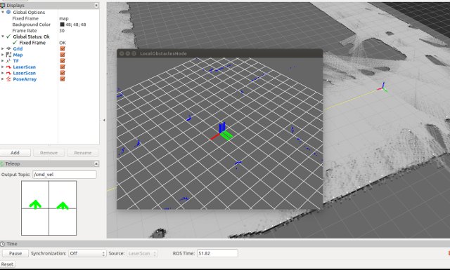
- Show an independent window with a 3D view of the local obstacles map
Required tf Transforms
<value of ~frameid_robot> (typ: base_link) → <each sensor frameid> (typ: scan, etc)- local pose of each sensor on the robot
- pose of the robot on the reference frame
Demo
This demo requires mvsim. It simulates one robot with 2 laser scanners and builds and publish the local obstacle maps to /local_map_pointcloud:
roslaunch mrpt_local_obstacles demo_with_mvsim.launch


